venerdì 28 marzo 2014

POKHARA: IL TEMPIO DELLA PACE / PEACE TEMPLE

Il Tempio della Pace nel mondo (Shanti Stupa), luogo sacro per i Buddhisti e gli Hinduisti.
 
The World Peace Temple (Shanti Stupa), a sacred site both for Buddhists and Hindus.


Il Tempio della Pace (Shanti Stupa) è un tempio (“Stupa” in sanscrito significa “tempio”) sacro, meta di pellegrinaggio di Buddhisti e Hinduisti. Inoltre, è fra le destinazioni più frequentate dai turisti per l'ampio panorama che si gode a 360°: dalle cime himalayane alla ricca valle dove 
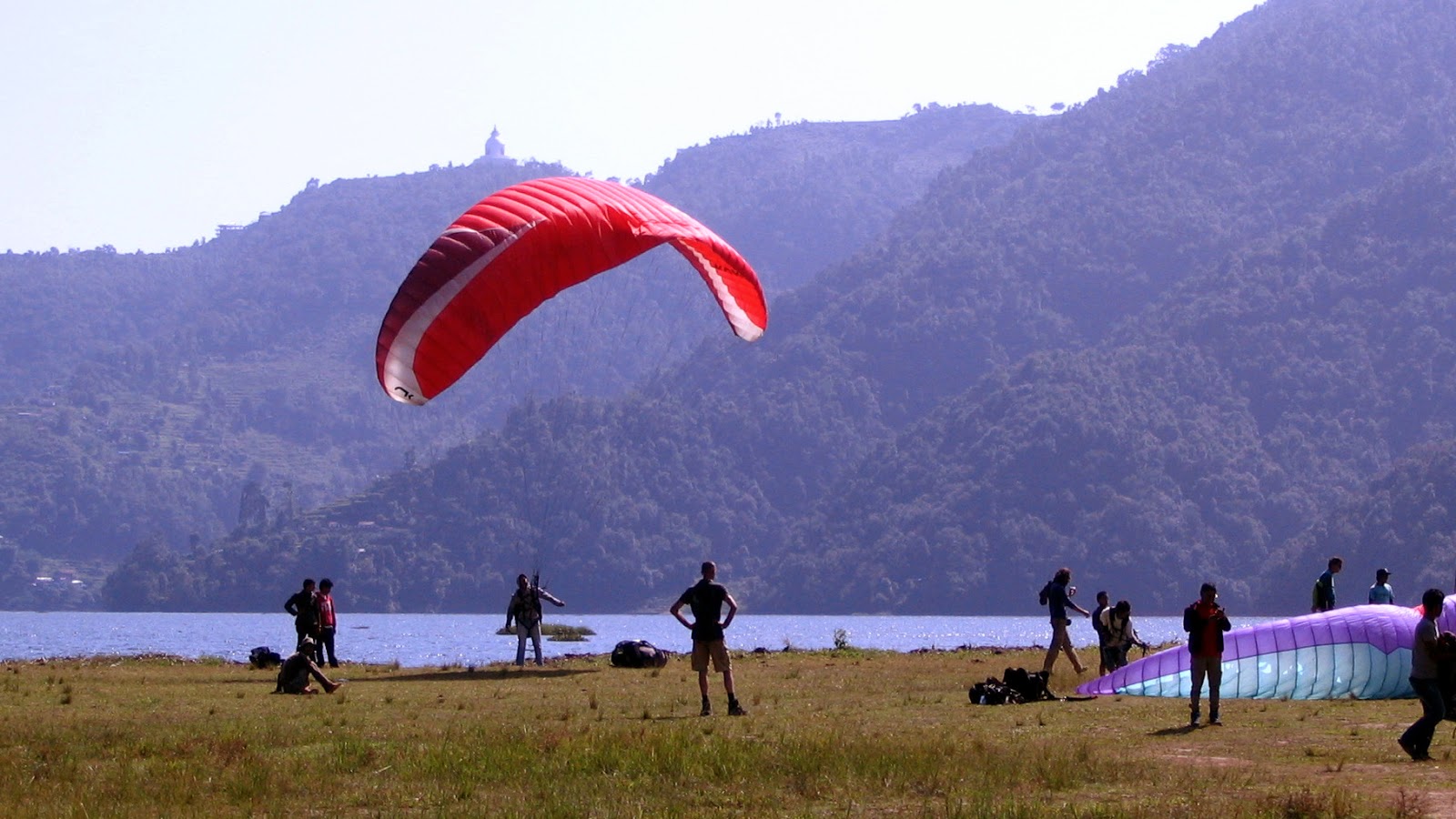
giace la città di Pokhara, dai campi terrazzati al Lago Phewa (Phewa Tal). La bianca costruzione si trova su di un poggio a 1100 metri di quota, proprio di fronte a Sarangkot. Una strada asfaltata porta sul crinale. Sono venti minuti d'auto da Pokhara... Ottobre. Non siamo fortunati. La giornata non è delle migliori. La coda del monsone indiano si fa ancora sentire. Tempo imbronciato con grosse nuvole nere. Pioggia a tratti. Abbiamo a disposizione un taxi con autista che, per l'occasione, ci fa anche da guida. L'edificio, imponente e di recente costruzione, è un simbolo di pace (“Shanti” in sanscrito significa “pace”). Il suo colore di un bianco brillante è un faro di luce ben visibile da tutta la valle sottostante. A pianta circolare, vi si accede tramite un' ampia scalinata con una struttura a due livelli. Al secondo livello si eleva l'alta cupola che ospita le quattro grandi statue del Buddha, rivolte verso le quattro direzioni cardinali, Nord, Sud, Est, Ovest. Dal forte significato simbolico, rappresentano altrettanti importanti passaggi della vita di Gautama Buddha, collegati con le località dove ebbero luogo. Vale a dire...
LUMBINI (Nepal): vi nacque il principe Siddhartha, il futuro Buddha storico, verso il 563 a.C.
BUDDHAGAYA (India): dove, all'età di 35 anni, raggiunse lo stato di Illuminazione e divenne il “Buddha”.
ISIPATHANA (India): il luogo del suo primo sermone.
KUSINARA (India): qui morì nel 486 a. C.
Fotografie di R. Frigerio


POKHARA:  THE WORLD PEACE STUPA

The World Peace Temple (Shanti Stupa) is a prominent pilgrimage sacred site both for Buddhists and Hindus and a popular tourist destination in Pokhara. The white temple lies on the ridge of a hillock at 1,100 metres above sea level, just opposite Sarangkot. From here you can have a bird's-eye view ranging from the Himalayan peaks to the city of Pokhara, from the richly cultivated terraced fields to the still waters of Lake Phewa (Phewa Tal). A twenty minutes' ride on a black-topped road leads us up the hillside to the summit. Our taxi driver reveals himself to be a good tour guide, when necessary. October... Bad weather due to unexpected monsoon rains, though! The temple (“Stupa” meaning “temple” in Sanskrit), a grand and imposing building, is a symbol of universal peace (Shanti meaning peace in Sanskrit). Its brilliant white colour is a beacon of pure light, clearly visible from the valley below. A circular building, you have access to its tiers, by going up the stone stairs. The dome, rising on the second tier, displays four impressive statues of Lord Buddha, placed at the four compass points. Each statue represents a major event in his life and is named according to the place where it took place. So we have...
LUMBINI (Nepal): the birthplace of Prince Siddhartha, the future Buddha, about the year 563 BCE.
BUDDHAGAYA (India): there he attained Enlightenment and became the “Buddha”. He was 35.
ISIPATHANA (India): the place where he delivered his first sermon to his followers.
KUSINARA (India): where he died in 486 BCE.
Photographs: courtesy of R. Frigerio

 
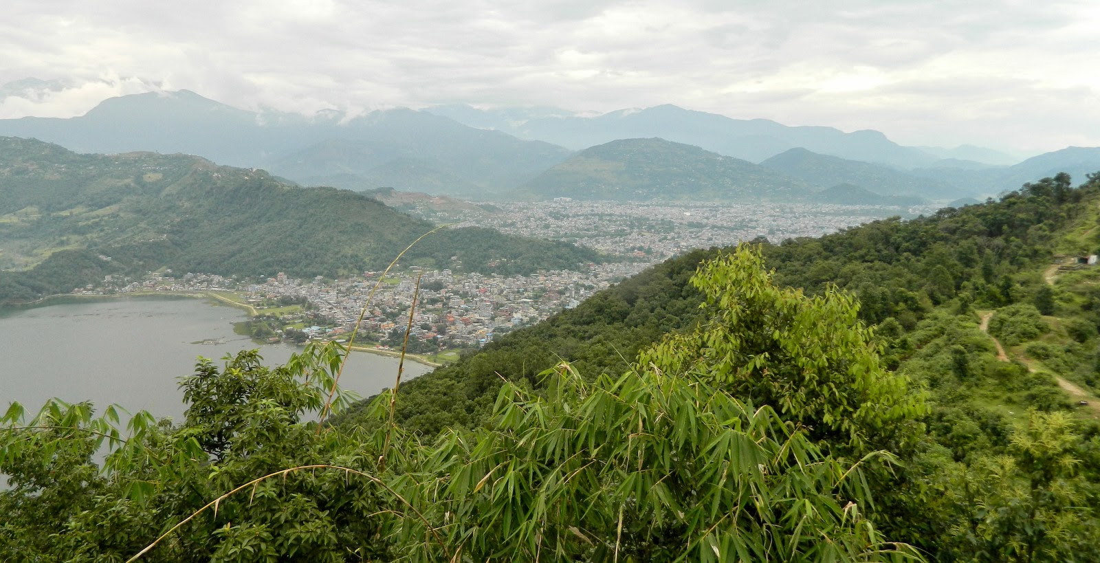
Il Lago Phewa e la Città di Pokhara dal Tempio della Pace.

Phewa Lake and Pokhara City as seen from the Peace Temple.


"Si prega di togliersi le scarpe", recita il cartello alla base del monumento.

Please take off your shoes herereads the sign, at the very base of the temple.


Il Tempio della Pace (particolare).

The Peace Temple (detail).


LUMBINI: La statua, sul lato sud, rappresenta il luogo di nascita del Buddha.

LUMBINI: The statue, on the south, represents Lord Buddha's birthplace.


BUDDHAGAYA: La statua, sul lato ovest, rappresenta il Buddha ed il suo stato di Illuminazione.

 BUDDHAGAYA: The statue, on the west, represents Lord Buddha when he obtained Enlightenment.


ISIPATHANA: Il Buddha, statua sul lato est, ed il suo primo sermone ai discepoli.
 
ISIPATHANA: Lord Buddha (the eastern statue) delivering his first teaching to his followers.


KUSINARA: Dove morì il Buddha (statua sul lato nord).

KUSINARA: Lord Buddha's place of death (the northern statue).


Panoramica sulla valle. La statua a sinistra è in onore di Min Bahadur Gurung. Fu lui a donare il terreno per la costruzione del tempio.

A bird's-eye view over the valley. The statue on the left was placed to honour Min Bahadur Gurung who donated the land to build the monument.


Il Tempio della Pace (Shanti Stupa) da Sarangkot.

The Peace Temple (Shanti Stupa) as seen from Sarangkot.


venerdì 21 marzo 2014

PARAPENDIO... CHE PASSIONE! / PARAGLIDING... JUST FOR THE FUN OF IT!


Il periodo migliore per il parapendio a Pokhara va da ottobre ad aprile. Sul lungolago trovate un buon numero di agenzie tra cui scegliere.

October through April is the best period for paragliding in Pokhara. Along its Lakeside you have a good number of paragliding companies to choose from.
 
PARAPENDIO... CHE PASSIONE!

Sarangkot è un ridente villaggio pigramente adagiato su di crinale a circa 1600 m sul livello del mare. Si trova a nord di Pokhara, la seconda città più importante del Nepal, dopo Kathmandu. Da Pokhara vi arriviamo in 45 minuti d'auto su per una strada stretta e tortuosa, dal fondo sconnesso, che conduce alla sommità della montagna. Da qui si può godere, nelle giornate limpide, della veduta di tre gruppi montuosi che superano gli 8000 metri ed altre cime minori. Da ovest ad est, in successione, abbiamo la visione superba del Dhaulagiri (8167 m), degli Annapurna, (con la cima più alta di 8091m) e del Manaslu (8163 m). Su tutte spicca, riconoscibilissimo per la sua forma piramidale il Machhapuchhare (6993 m), meglio noto come il “Cervino dell'Himalaya” per la sua straordinaria ed impressionante somiglianza con la nostra montagna. Il taxista che ci conduce nel primo pomeriggio di una bella giornata di fine ottobre, è alquanto ciarliero. Gli chiedo, fra l'altro, il numero degli abitanti della città di Pokhara, che appare in tutta la sua vastità dall'alto del monte sotto di noi. Non sa darmi una indicazione precisa... Forse 300.000... Mi fa notare l'eccessivo inurbamento degli ultimi anni, conseguenza del conflitto armato tra il potere centrale e i guerriglieri del partito comunista. Gli chiedo in quale senso. Aggiunge che molti abitanti delle aree rurali e montuose, per sfuggire alle continue e pressanti richieste di cibo e di asilo dei Maoisti, erano fuggiti per rifugiarsi nella piana di Pokhara. Il conflitto armato con l'obiettivo di rovesciare la monarchia, era durato circa 10 anni, dal 1996 al 2006, e causato 16.000 vittime.

Il costo della corsa, andata e ritorno, comprensivo di un paio d'ore di sosta, è di 500 rupie (neppure 4 euro). Lasciata l'auto con l'autista ad attenderci, ci inerpichiamo lungo la ripida scalinata che porta al punto più alto. Un breve spiazzo erboso, su di un vuoto di 800 metri che dà sul lago Phewa sottostante. Ospita un certo numero di appassionati che qui vengono da ogni parte del mondo, a praticare il parapendio. Dopo una breve rincorsa, le vele si gonfiano ed un attimo dopo li vedo effettuare il grando balzo. Sollevo gli occhi. Il cielo è punteggiato da grandi aquiloni. Un caleidoscopio di colori. Volteggiano lentamente in grandi cerchi concentrici sotto lo sguardo superbo dei giganti himalayani. Restiamo affascinati davanti ad un simile spettacolo.

Fotografie di R. Frigerio e F. Vido


PARAGLIDING... JUST FOR THE FUN OF IT!

Sarangkot is a small pleasant village lazily lying in the sun on a ridge at about 1,600 m above sea level. It is to the north of Pokhara, the second most important city in Nepal, after Kathmandu. From Pokhara a forty-five minutes' ride leads us there up a narrow bumpy winding road. From the mountaintop, in crystal clear sunny weather, you can enjoy the view of three himalayan mountains above 8,000 m as well as a number of minor peaks. From west to east, in a sequence, you have a stunning sight of Mt. Dhaulagiri (8,167m), Mt. Annapurna (8,091m) and Mt. Manaslu (8,163m). Moreover, the perfect pyramid of Mt. Machhapuchhare (6,993m) stands out against the blue sky, easily recognizable for its shape which has earned itself the name of the “Matterhorn of the Himalayas”. It is a sunny autumnal afternoon, late in October. The taxi driver, sitting to my right, is quite talkative. I ask him, among other things, how many people live in Pokhara, which appears so vast below us. He hesitates for a while... 300,000 people... maybe. Then he adds: ”The excessive urban migration in recent years is a result of the armed conflict between the central power and the guerrillas of the Communist Party.”... He explains: “You see... lots of the inhabitants of the mountainous and rural areas, in order to avoid the incessant demands for food and accommodation from the Maoists, left their homes to take refuge and protection in the valley of Pokhara.” The warfare to overthrow the monarchy lasted about ten years, from 1996 to 2006, and caused 15,000 casualties. 
The taxi return fare, inclusive of a stop for a couple of hours is 500 rupees per person, about five dollars. We leave the driver at the parking lot and start climbing up the steep concrete steps leading to the mountaintop. A small open space amid cultivated fields looks onto Phewa Tal (Lake) and Pokhara Valley, 800 metres beneath. It is probably one of the most famous launching spots for paragliders in Nepal. A number of young people from every part of the world are gathered. A short run forward, their wings inflated, they jump off the ramp. I raise my eyes. The sky is dotted with gliders. A kaleidoscope of bright colours. They wheel high above. Slowly. The himalayan giants in the background. What a sight!

Photographs: courtesy of R. Frigerio and F. Vido


Lo spiazzo erboso da cui si effettuano i lanci.

 The launch site, on top of the mountain at Sarangkot.


Il lancio.

Jumping off the ramp.


Le termiche aiutano a salire.

Using thermals you fly high in the air.


Un caleidoscopio di vivaci colori.

 A kaleidoscope of bright colours.


La città di Pokhara con il Lago Phewa.

The City of Pokhara and its lake (Phewa Tal).


Alti su Sarangkot con le montagne himalayane sullo sfondo.

Soaring high above Sarangkot with the Himalayas in the background.


Panoramica sul lago e la valle di Pokhara.

The lake and a full view of Pokhara Valley.


Il fascino dell' Annapurna e del Machhapuchhare.

The spectacular view of Mt. Annapurna and Mt. Machhapuchhare.


Il Machhapuchhare, 6993 m, il "Cervino Himalayano" (telefoto).

Mt. Machhapuchhare, 6,993 m, the "Matterhorn of the Himalayas" (telephoto).


Kharare, l'atterraggio. Lungolago di Pokhara.

Khahare, the landing ground. Pokhara Lakeside.